From AI Maps to School Sensors: How 16-Year-Old Kelly Liu Turned Air Pollution Data Into Action
Air-quality reports can tell residents whether pollution is elevated across a city. For Kelly Liu, that left a more immediate question unanswered: what was happening around individual schools?
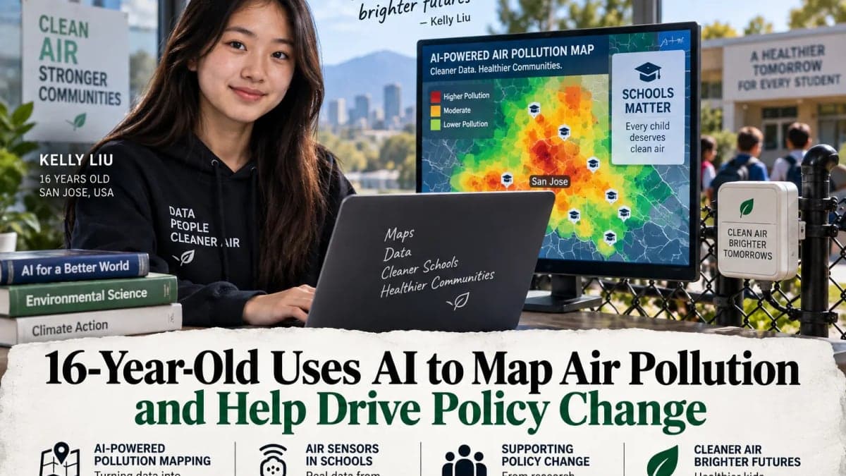
The 16-year-old San Jose student began looking at pollution on a much smaller geographic scale, combining artificial intelligence with environmental data to identify places where children could face greater exposure. She then moved beyond computer analysis, helping bring low-cost air-quality sensors into underserved schools and using the resulting work to support a push for government action.
What began as a technical project became an exercise in translating data into something communities and policymakers could use.
Looking Beyond Citywide Air-Quality Readings
Air pollution can change considerably within a relatively small area.
Traffic corridors, industrial activity, freight movement and other local conditions can leave one neighbourhood with a different pollution burden from another nearby. Regional monitoring stations are designed to track broader air quality, but they cannot measure conditions outside every school or on every street.
Liu focused on that gap.
Rather than attempting to replace official monitoring, she used available environmental and geographic information to examine where pollution risks might be concentrated. Schools became an important part of the project because broad regional averages may not fully describe the conditions students experience during the day.
The challenge was finding a practical way to make large and sometimes disconnected datasets useful at that level.
AI Helped Liu Find Patterns in the Data
Artificial intelligence became part of the analytical process.
Liu used AI-assisted methods to work through environmental and geographic data and examine connections among pollution, school locations, traffic and surrounding conditions. Mapping those relationships made it possible to compare neighbourhoods and identify areas that warranted closer attention.
The role of AI needs some precision.
It did not directly measure the air. Pollution measurements came from environmental records and physical sensors. AI helped Liu organise and analyse information, identify patterns and present the results geographically.
That distinction is central to understanding the project. The technology was useful because it helped make a complicated environmental problem more legible, not because an algorithm could substitute for measurements taken on the ground.
Taking Pollution Monitoring Into Schools
Once the mapping work identified gaps worth investigating, the project moved closer to the communities involved.
Low-cost air-quality sensors were placed at underserved schools, allowing pollution to be monitored much nearer to where students actually spent their time.
Such sensors are not identical to regulatory-grade monitoring stations and their readings have to be interpreted with appropriate care. Their advantage is accessibility. They can expand the number of locations being observed and provide a more local picture of how conditions vary.
For a school community, that difference can be significant.
A regional monitor several miles away can provide an important measure of overall air quality. A sensor closer to a campus can add another layer of information about conditions in the immediate surroundings.
Liu's project used the two ideas as complements rather than treating local sensors as replacements for established monitoring systems.
The Project Moved Beyond Research
Collecting data was only part of the work.
Liu also took the findings into a wider conversation about who has access to detailed environmental information and whether existing monitoring adequately captures conditions in communities with fewer resources.
That gave the project an environmental-equity dimension.
Pollution exposure and access to monitoring infrastructure do not necessarily fall evenly across a region. Communities located near busy roads, industrial sites or other emission sources may have a strong interest in hyperlocal measurements, particularly when regional averages do not show what residents experience close to home.
Liu's work brought together mapping, sensors and community advocacy around that issue.
Reporting on the project credits her efforts with helping build momentum for broader countywide policy action. The distinction is worth preserving: her work contributed to the push for change, rather than demonstrating that one student project alone produced a government decision.
Why Better Maps Can Change the Policy Conversation
Environmental policy depends heavily on what can be measured.
When officials work primarily with regional averages, a pollution problem concentrated around a particular school or neighbourhood can be difficult to distinguish from the wider picture. More granular data can help identify locations that deserve further investigation.
It does not automatically prove the source of pollution, establish health effects or determine what policy should follow. Those questions require appropriate scientific analysis and regulatory scrutiny.
What hyperlocal monitoring can do is make disparities easier to see.
For schools, that information may help administrators, families and public agencies decide whether more rigorous monitoring is needed and where resources should be directed.
That is where Liu's project moved beyond an exercise in building an AI model. The maps were a starting point. Sensors provided additional observations, while community engagement connected those findings with people in the places being studied.
A Practical Use of AI Outside the Generative-AI Boom
Liu's work also sits outside the most familiar public narrative about artificial intelligence.
Much of the current debate around AI centres on chatbots, image generators, workplace automation and increasingly powerful general-purpose models. Environmental research presents a less visible but established use case: applying computational methods to large datasets to find patterns that would be difficult to examine manually.
In Liu's project, AI was one component of a broader system.
Environmental measurements supplied the evidence. Geographic information provided context. Sensors brought monitoring closer to individual communities. AI helped make sense of the resulting information.
The final step required people.
For environmental data to influence public decisions, findings have to be understandable to residents, educators and officials. They also need to be presented with enough care that the limits of the measurements remain clear.
Liu's work progressed from analysing pollution to participating in that larger process.
At 16, she did not solve the problem of urban air pollution. Her project did something more specific: it showed how a student could use modern analytical tools to ask a local question, gather evidence around it and bring that evidence into a policy discussion.
The technology helped draw the map. The harder work was connecting what appeared on it to the communities breathing the air.